
Postcodeheatmap
Turn your spreadsheets into beautiful map visualizations
What is Postcodeheatmap?
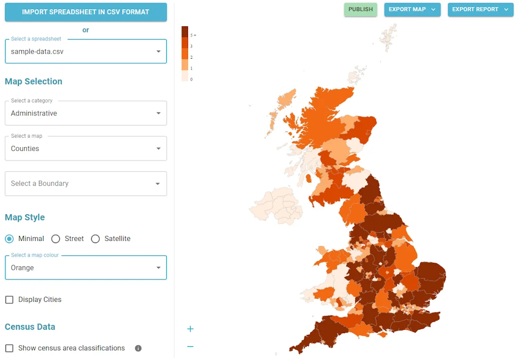
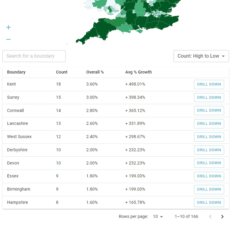
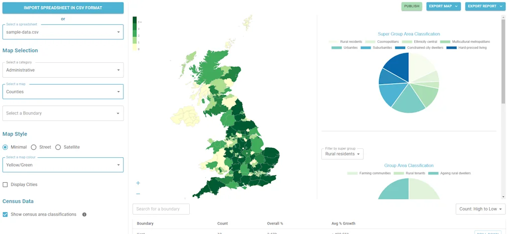
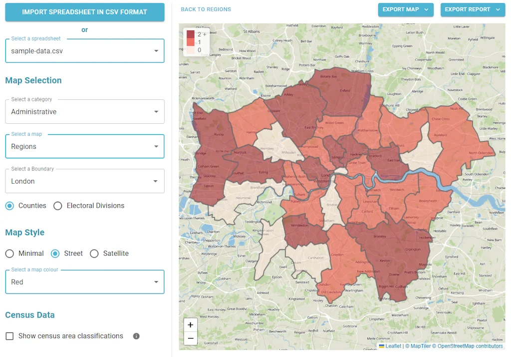
A super simple tool to visualise your customer density across UK geographic boundaries such as counties and regions. Just upload a spreadsheet of postal codes and then export your heat maps as images or generate reports.
Tool Details
| Categories | Data analysis tools, Data visualization tools, Business intelligence software |
|---|---|
| Website | postcodeheatmap.com |
| Added | March 5, 2024 |
| Platforms | Web |
Frequently Asked Questions about Postcodeheatmap
When did Postcodeheatmap become popular?
Postcodeheatmap became popular around March 5, 2024.
What type of tool is Postcodeheatmap?
Postcodeheatmap belongs to the following categories: Data analysis tools, Data visualization tools, Business intelligence software.
Related Data analysis tools Tools
Caliper
Providing visibility into your company's cloud spend
Review Scraper API
Reviews from 50+ sites in JSON
BayesLab
From deep analysis to premium slides, agentized
Latitude
Open-Source Framework for Embedded Analytics
Label Your Data
Data annotation solution for ML datasets
Private Company Database by Crustdata
Realtime Funding And Headcount Growth Metrics on 2M+ cos
Related Data visualization tools Tools
Related Business intelligence software Tools
Launchdeck
Digital sales rooms that win sales & close deals
Campana
Stay Ahead of Your Competitors in Just 5 Minutes a Week
ChartMogul
Unlock the full revenue potential of your SaaS business
Actiondesk
Access and explore all your live data in one place.
mata
A startup suite for emerging entrepreneurs
Satchel
Guides to the best SaaS tools
Compare Postcodeheatmap :
Don't Get Fooled by Fake Social Media Videos
The world's first fact checker for social media. Paste any link and get an instant credibility score with sources.
Try FactCheckTool Free